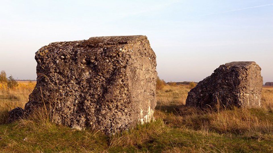
Nordre Klapper, Koklapperne and Svenskeholm were islands in the Kalvebod Løb channel. Svenskeholm (Swedish island) got its name because Swedish soldiers camped here during the siege of Copenhagen in the Dano-Swedish War of 1658-60.
The peasants of Amager sailed their cattle to graze on Koklapperne in the summer months.
Land reclamation
In the mid-1800s, the peasants had to stop letting their cattle graze on the west coast of Amager, which back then was protected by the Mejlgård Dyke between what is now Finderupvej and Bella Center Copenhagen. The military set up a target range on Amager Fælled and the coastal area was designated as a security zone.
Even at this time, land-reclamation projects in these shallow waters between Zealand and Kalvebod Strand beach were being considered. Building dykes would make it possible to deepen the channel, gain more fertile land, and provide the military with larger areas.
However, legislation authorising reclamation of Kalvebod Strand etc. was not passed until 1939, as an employment project to reduce the high unemployment of the time. Because of the German occupation of Denmark in 1940, and to stop unemployed Danes being sent to Germany on forced labour, the work was started the year after.
In 1943, the about 14-km-long and four-metre-high dyke was finished, and canals and ditches were dug, so that water could be pumped out from the around 20-km2 area, which was drained in a matter of months. During the work, thousands of birds settled in the reclaimed area, and the south-westerly part became a bird sanctuary in 1952. It was listed in 1990. In the late summer of 2012, the coastal protection was fortified by a 5.9-metre-high dyke behind the old one.
Military zone
In 1943, the military took over the newly dammed-in area as a training area, but left Amager Fælled to be used by the public. Vestamager has been cultivated, and nature has also taken over much of the area for itself. However, fallow deer have been introduced from Jægersborg Dyrehave forest. The military left Vestamager in 1984 and passed the area over to the Ministry of the Environment, which opened it to the public.
To begin with, access was limited because of live grenades, explosives and ammunition from more than 325 years of target practice in the area.
In 2010, paid for by Defence Command Denmark, the last of the ammunition was removed, for example 250 kg grenades. Now the whole area can be accessed except for an area around Klydesø lake.
Ørestad
In 1991, Denmark and Sweden entered into an agreement about a permanent link across the Oresund Strait. This had been discussed since the 1880s, and on 1 July 2000 the bridge was opened.
In 1992, Folketinget (the Danish Parliament) agreed that housing should be built in the around 3-km2 unused area between Islands Brygge in the City of Copenhagen, Tårnby and Kalvebod Brygge, and a light railway, the Metro, should be built. The first section, from Nørreport station to Vestamager, was ready for use in 2002.
The name Kalvebod Common (Kalvebod Fælled)
The 20-km2 natural area in Vestamager is also called Kalvebod Fælled. Until it was reclaimed in the middle of the last century, the area formed part of the seabed in the waters between Amager and Zealand, known as Kalveboderne. The waters stretched to the banks of Copenhagen and Christianshavn, but through centuries had become narrower through land reclamation and damming.
Kalvebod consists of the two words 'kalv' (meaning a small natural island) and 'bod' from the old Danish word 'bothi' (meaning undersea rock). Kalvebod is made up of small, island-like, undersea rocks.
‘Fælled’ is the old Danish word for the common grazing land around a town.
It is called Vestamager, because it simply is the westernmost part of Amager.
Timeline
8.000 BCE:
The last glacial period ends, the Oresund gla-cier melts.
5.000 BCE:
Denmark takes its current shape. A third of what is now Amager is still under water in the part of Koge Bugt known as Kalvebod Lob
1658-60:
The Swedes besiege Copenhagen and some of the soldiers live on the island, which came to be known as Svenskeholm, in Kalvebod Lob channel.
1850s:
Start of plans to possi-bly reclaim land from the sea between Zealand and Kalve-bod Strand beach.
1939:
Legislation to authorise construction of dykes at Kalve-bod Strand beach.
1941:
Launch of reclamation work.
1943:
Vestamager is created from 20 km2 of drained seabed.
1952:
Vestamager is earmar-ked as a sanctuary for birds and other animals.
1990:
Vestamager is listed.
1991:
Denmark and Sweden enter into an agreement about a permanent link across the Oresund Strait, and the Oresund link bridge is opened in 2000.
1992:
Act on Orestad, includ-ing the Metro, passed.
2002:
The first metro train leaves Norreport station for Vestamager.
2012:
The coastal protection is strengthened with a 5.9-metre-high dyke.
